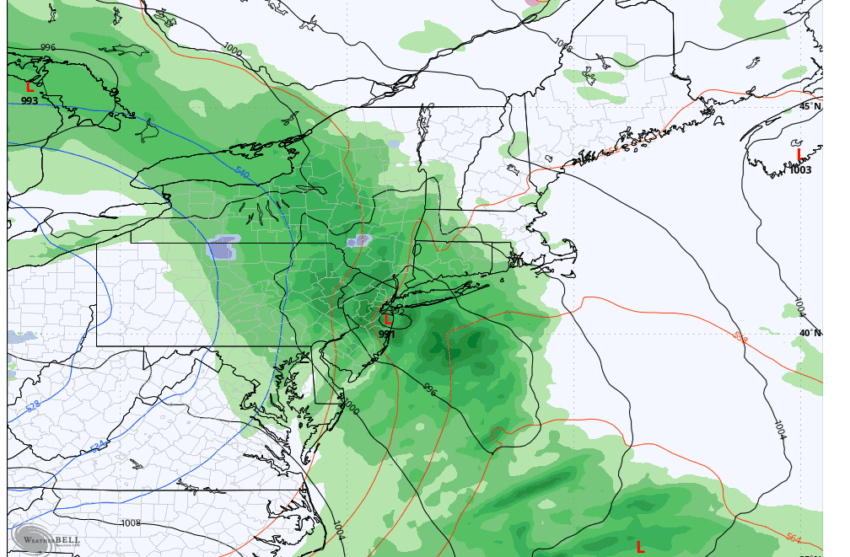
A weather system moving through the region on Wednesday evening is expected to bring much-needed rain, continuing overnight into Thursday morning, with scattered showers throughout the day. By Thursday evening, widespread rainfall totals of up to 1 inch are possible, with some localized areas potentially receiving up to 2 inches—significantly higher amounts than many areas have seen in the past month.
In addition to the rain, colder air moving into the region may bring a mix of wet snow, particularly in the higher elevations of the Catskills and Poconos. As an upper-level low pressure system moves over New York State, it will cause rapid upward motion in the atmosphere, cooling the air and pulling in cold air from mid-levels. This could result in rain transitioning to wet snow in parts of the Catskills and the Poconos on Thursday, with some areas potentially experiencing their first accumulating snow of the season.
The higher elevations of Sullivan, Western Ulster, Western Greene, and Delaware counties are expected to see the greatest snowfall totals, with some of the highest peaks possibly receiving over 6 inches. Residents in these colder, higher-elevation areas should be prepared for snowy conditions, especially Thursday night.
However, the weather system remains unpredictable. Meteorologists caution that the dynamic nature of the storm means there’s still a chance for wet snow to reach portions of the Hudson Valley, particularly in valley areas. There’s a 20% to 30% chance that rapidly cooling air and strong upward motion could lead to a brief period of snow across the region on Thursday.
For now, it’s a weather event that will require close monitoring as conditions develop over the next two days.
We go in-depth on this week’s forecast and talk about the winter ahead with Michael Kistner, Lead Meteorologist, National Weather Service, Binghamton.

